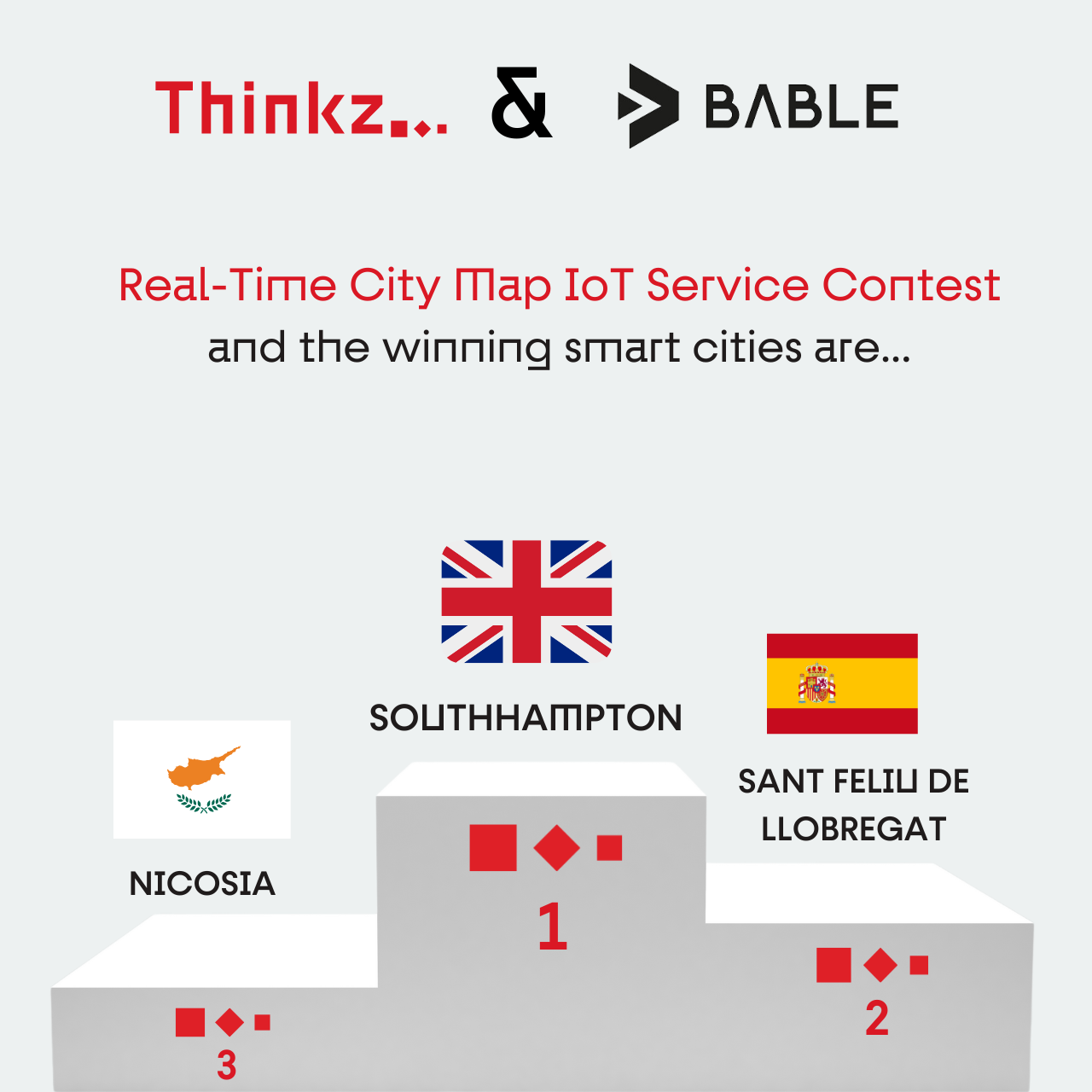
Join Thinkz & Bable Real-Time City Map IoT service Contest!
An Opportunity to Transform Your City with Real-Time IoT Data
Experience the Power of Real-Time presence: Get your city’s map animated in real time.
Choose Thinkz Real-Time services: The winner will have the opportunity to select one real-time service from our extensive list of available offerings.
IoT Integration on Thinkz Real-Time Map: We will integrate the city’s IoT data into our real-time map, bringing the chosen service to life.
Free Access for Citizens: The city’s inhabitants will enjoy free access to a dynamic, real-time map of the chosen service, fostering a smarter and more connected community.

Thinkz & Bable Contest – Smart City Real Time Map

Smart Cities Overcoming Urban Challenges in Europe
Innovative Strategies for Funding, Decision-making, and Public-Private Partnerships in Urban Development
In today’s world, cities rely increasingly on vast amounts of data to manage and enhance urban living. From traffic management and public safety to environmental monitoring and energy consumption, data forms the backbone of modern urban infrastructure. However, this dependency on data also presents significant challenges. For companies like Thinkz, addressing these challenges is crucial for successfully implementing smart city solutions.
1. Reliance on the European Budget
Cities often depend heavily on European funding to support their urban projects. While EU grants and subsidies provide essential financial support, this reliance can be a double-edged sword. Inconsistent fund availability and fierce competition can delay or halt important projects.

Solution: Diversifying Funding Sources
Diversifying funding sources is essential for resilience. Cities can explore public-private partnerships (PPPs), local investment incentives, impact investing, green bonds, and crowdfunding. These strategies reduce vulnerability to funding fluctuations, increase financial stability, and foster innovation.
Examples of Funding Sources for Municipalities:
- Public-Private Partnerships (PPPs): Engage private companies to finance and manage infrastructure projects, such as public transportation systems, parking facilities, renewable energy, and waste management.
- Local Investment Incentives: Offer tax breaks and zoning relaxations to attract businesses and developers, boosting property tax revenue and job creation.
- Impact Investing and Fees: Develop programs that attract private capital to projects with social or environmental benefits. Implement user fees for specific services like parking or congestion charges.
- Alternative Financing Models: Issue green bonds and explore crowdfunding for smaller-scale community projects.
- Monetization of Municipal Assets: Lease or sell underutilized assets to generate revenue while ensuring public benefit.
By adopting these strategies, municipalities can create a more diversified and resilient financial future, supporting essential services and infrastructure projects while improving citizens’ quality of life.
2. Slow and Complex Decision-Making Processes
Bureaucratic red tape and the need for consensus among stakeholders often slow down the decision-making processes in cities. Even well-established suppliers can find it challenging to navigate these complexities.

Solution: Streamlining Procedures and Embracing Innovation
Streamlining internal procedures and adopting agile governance models can accelerate project approval and execution. Embracing digital platforms for collaboration and communication among stakeholders fosters a more dynamic and responsive urban management environment.
Examples of Agile Governance Models:
- Citizen-Centric Agile Governance: Empower citizens to participate directly in decision-making through online platforms, idea submission, and voting on proposals.
- Decentralized Service Delivery: Deliver services through empowered, cross-functional teams focused on specific neighborhoods, fostering local responsiveness.
- Agile Budgeting and Resource Allocation: Replace lengthy budgeting processes with iterative cycles that allow faster adjustments based on real-time data.
- Open Data and Collaborative Problem Solving: Make municipal data available to citizens for collaborative problem-solving through hackathons and innovation challenges.
- Performance Measurement and Citizen Feedback: Focus on citizen well-being and satisfaction through regular surveys and open forums.
These models increase citizen engagement, improve efficiency and responsiveness, enhance innovation, better allocate resources, and ensure transparency and accountability.
3. Political and Bureaucratic Hurdles
Political changes and bureaucratic inertia can disrupt long-term planning and stifle innovation. Differing priorities and shifts in focus can affect funding allocation and project continuity.

Solution: Building Strong Public-Private Partnerships
Building strong public-private partnerships (PPPs) can overcome these hurdles. Collaboration between government agencies, private companies, and civil society creates a supportive ecosystem for innovation. Continuous dialogue and aligning on common goals ensure project continuity despite political changes.
Examples of Strong Public-Private Partnerships:
- London’s Docklands Development: Revitalized a former industrial area into a thriving district through a successful PPP.
- Los Angeles International Airport (LAX) Modernization: Funded and managed a multi-billion dollar modernization project, enhancing passenger experience.
- Singapore’s Mass Rapid Transit (MRT) System: Delivered a world-class public transport network through a successful PPP model.
Building strong PPPs requires commitment, but the benefits include leveraging private sector expertise and resources to deliver essential services, infrastructure, and economic development, ultimately improving citizens’ well-being.
At Thinkz, we understand these challenges and we are ready to work with you to overcome them.
Conclusion: Overcoming Urban Challenges
The path to transforming urban environments into smart cities is paved with challenges, but it also offers unparalleled opportunities for innovation and growth. By addressing these key obstacles—dependence on European funding, slow decision-making processes, and political and bureaucratic hurdles—cities can unlock their full potential and create more resilient, efficient, and livable urban spaces.
1. Diversifying Funding Sources: By exploring a variety of funding options such as public-private partnerships, local investment incentives, and alternative financing models like green bonds, municipalities can reduce their reliance on European funds and secure a more stable financial future. This enables continuous investment in essential services and infrastructure, ultimately enhancing the quality of life for citizens.
2. Streamlining Procedures and Embracing Innovation: Implementing agile governance models and embracing digital platforms for collaboration can significantly speed up decision-making processes. This not only accelerates the implementation of smart city projects but also ensures that these projects are more responsive to the needs of the community.
3. Building Strong Public-Private Partnerships: By fostering strong collaborations between government agencies, private companies, and civil society, cities can navigate political and bureaucratic challenges more effectively. These partnerships bring in private sector expertise and resources, driving innovation and ensuring the successful delivery of essential services and infrastructure.
Together, these strategies can transform the challenges of today into the smart cities of tomorrow, paving the way for a smarter, more sustainable future for urban living.
Thinkz we did
Use cases that are already leveraging
the Power of Real-Time Data




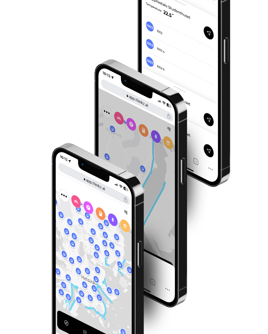
 REAL-TIME Digital Twin Mobility – Helsinki city
Revolutionizing Helsinki’s Snow Plow System with Digital Twin Technology
Insights:
The residents and transportation services in the snowy city of Helsinki require up-to-date information on which roads have been cleared of snow in real-time. This information is crucial in helping them plan their journeys more safely and efficiently, whether it be choosing their route or determining if public transportation is an option.
Problem:
Residents of snowy cities require real-time updates on which roads have been cleared of snow to plan their journeys more safely and efficiently.
Solutions:
Real-time snowplow mapping uses intelligent technologies and mapping software to track and display snowplow locations and progress. By harnessing the power of IoTs on the city’s snow plows and other connected devices, the collected data can be transformed into real-time information and displayed on a live map.
The solution also includes multiple layers of information, connecting the snow-cleared route map to the city’s public and private transportation systems. The revolutionary pattern pending LDV technology by Thinkz ensures the accuracy of the data by connecting and verifying multiple sources of IoT data in real-time.
Digital Twins technology allows the solution to connect other IoT devices in the city, providing data from multiple sources in real-time. This data is transformed into a single, verified information source through the revolutionary pattern pending LDV technology by Thinkz.
Advantages:
Real-time snowplow mapping offers many benefits for the citizens :
Real-time road condition updates:
Enhances driver safety and informs route decisions.
Travel planning made easy:
Residents can plan trips and errands based on cleared roads.
Avoid uncleared roads:
Real-time mapping helps minimize travel time and reach destinations faster.
Informed route choices:
Reduces accident risk and improves overall road safety.
Current road status information:
Alleviates concerns and promotes peace of mind for residents.
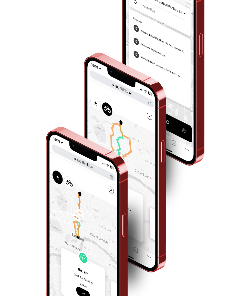
 Real-Time Air quality & Mobility – Westminster London City Hall
Dynamic Clean-Air Routing: Utilizing IoT for Sustainable Living & Urban Mobility
Insights:
Access to real-time air quality data is essential for citizens to make informed decisions about their daily activities, leading to a healthier and more sustainable environment for all.
Problem:
Isolation of IoT devices due to cyber protection and privacy concerns prevents citizens from accessing air quality information. The challenge is to create a global network of IoT devices to provide free access to real-time air quality data in urban areas.
Solutions:
Collaboration between IoT devices provides boundless possibilities for enhancing urban living. Our innovative technology assimilates data from a variety of IoT devices, including CO2 sensors, to offer citizens real-time maps detailing the quickest and cleanest walking or cycling routes to their destinations.
This GDPR-compliant solution also delivers crucial information such as travel duration, air pollution levels, and street capacity.
The revolutionary pattern pending LDV technology by Thinkz ensures the accuracy of the data by connecting and verifying multiple sources of IoT data in real-time.
We are not data aggregators: All your data stays within your system. Further, we don’t collect or store data from end users and IOT devices.
Advantages:
Since DECEMBER 2022- Westminister’s citizens get access to cleaner air routes
Real-time air quality insights
enable informed decision-making for citizens’ daily activities, promoting healthier and more sustainable lifestyles.
Breaks the barriers of IoT device isolation
by harmonizing data from diverse IoT devices, including CO2 sensors and pedestal route.
Providing real-time maps
presenting the fastest and cleanest routes to citizens’ destinations.
Enhancing daily commuting experiences,
fostering more efficient and sustainable urban living.
Citizens can use Thinkz’s user-friendly real-time map to view all relevant air quality data on their route, empowering them to make informed decisions about their daily activities.
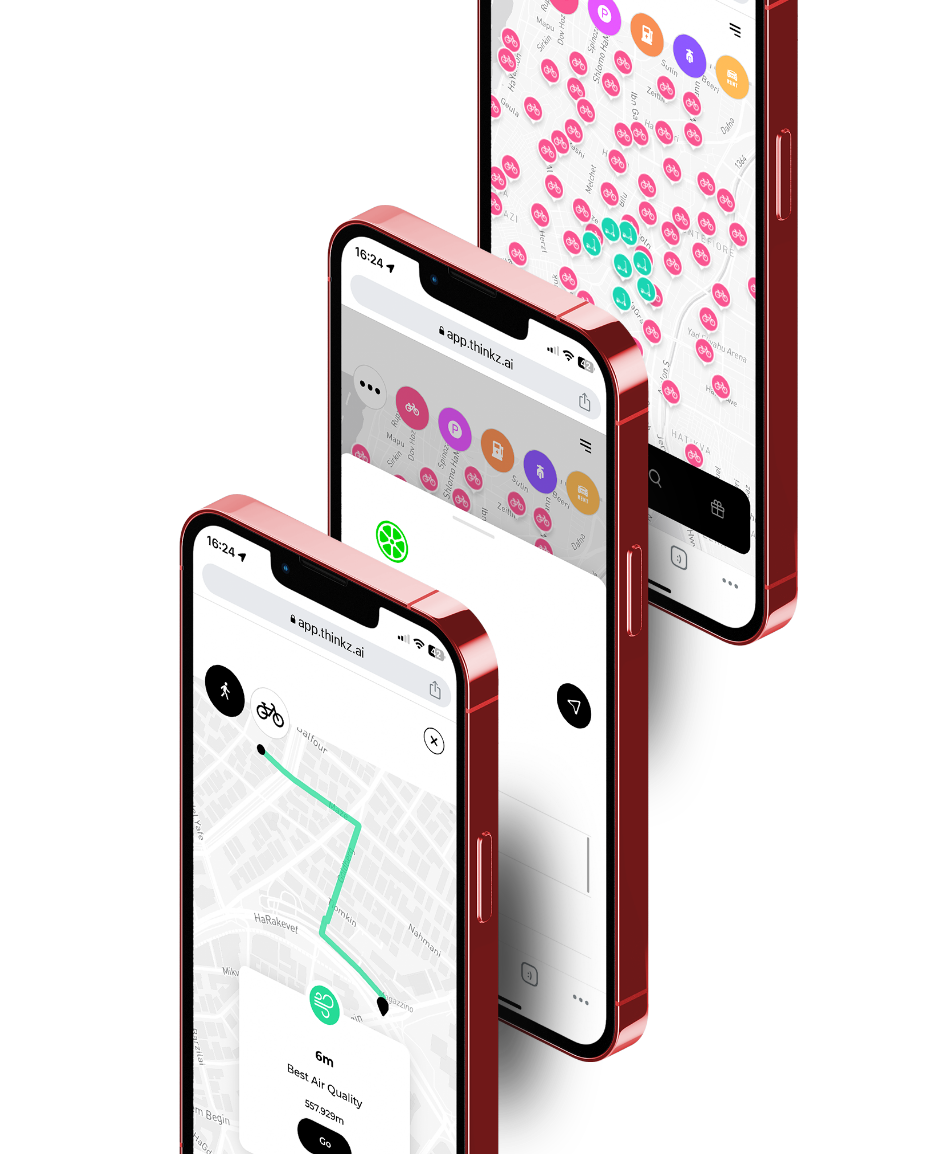
 Real-Time Mobility – Tel Aviv
Dynamic Clean-Air Routing: Utilizing IoT for Sustainable Living & Urban Mobility
Insights:
Tel Aviv, known for its vibrant life and bustling streets, offers an extensive range of micromobility options. Despite this, these options are spread across numerous apps, creating a disjointed experience for residents who cannot access real-time, consolidated information
Problem:
How to provide city residents with comprehensive, real-time information on all available public transportation options?
This requires the integration of unused data from multiple IoT devices, each with different owners and protocols, and the establishment of a machine-learning Live data verification to ensure data accuracy.
Solutions:
Thinkz addresses this issue with a unified platform providing real-time insights into all available micromobility options, including scooters and electronic rentals. This easily navigable, interactive real-time map is accessible on both mobile and desktop interfaces. It includes real-time information on available e-scooters, e-bikes, and other relevant public transportation options.
Our GDPR-compliant solution delivers vital information such as the availability and battery level of e-scooters and e-bikes, helping users make informed choices.
With Thinkz’s groundbreaking LDV technology, we ensure data accuracy by connecting and verifying multiple real-time IoT data sources.
Your data security is our priority. We don’t aggregate data; all your data stays within your system. Additionally, we don’t collect or store data from end users and IoT devices.
Advantages:
Since September 2022, Tel Aviv residents have been reaping the benefits of the Mobility 360° platform
Enhanced Convenience
Provides real-time information on the availability and location of e-scooters, e-bikes, and public transportation, simplifying planning and reducing search times.
Improved Mobility
With real-time updates on diverse transport modes, residents can make informed decisions to efficiently reach their destinations.
Sustainability Promotion
By providing real-time data on e-scooters and e-bikes, Thinkz’s platform promotes eco-friendly transportation.
Time Efficiency
Instant visibility of available transport modes reduces travel and waiting times.
Boosts Public Transport Usage
Real-time updates on public transportation schedules can motivate more residents to use these services, reducing congestion and carbon emissions.
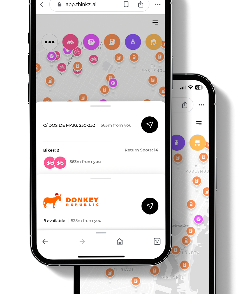
 Real-Time Mobility 360° – Barcelona
Streamlining Urban Transport for Barcelona’s Residents through Mobility 360°
Insights:
While the city of Barcelona offers an array of options for optimizing urban mobility, these solutions are scattered across multiple applications. This fragmentation prevents residents from having a centralized and comprehensive overview of real-time mobility solutions.
Problem:
How to create a unified platform that provides city residents with comprehensive, real-time information on all available mobility options.
Solutions:
Thinkz addresses this challenge by presenting a centralized, real-time view of various mobility options, including micro-mobility devices such as scooters and bikes, along with real-time information for drivers such as available parking spots and EV charging stations. This solution manifests in a multi-layered, interactive, real-time map that’s intuitive to use on both mobile and desktop interfaces.
Our GDPR-compliant solution also provides vital details such as scooter and bike battery levels, the availability of return spots, and the number of available parking spaces.
Live Data Verification (LDV): Thinkz’s innovative and patent-pending LDV technology ensures data accuracy by verifying and connecting multiple sources of IoT data in real-time.
At Thinkz, we prioritize your data security: we do not aggregate data, and all your data remains within your system. Furthermore, we do not collect or store data from end users or IoT devices.
Advantages:
Since September 2022, Barcelona’s residents have benefitted from the Mobility 360° platform:
Enhanced Convenience
Provides real-time information on the availability and location of e-scooters, e-bikes, and public transportation, simplifying planning and reducing search times.
Improved Mobility
With real-time updates on diverse transport modes, residents can make informed decisions to efficiently reach their destinations.
Sustainability Promotion
By providing real-time data on e-scooters and e-bikes, Thinkz’s platform promotes eco-friendly transportation.
Time Efficiency
Instant visibility of available transport modes reduces travel and waiting times.
Boosts Public Transport Usage
Real-time updates on public transportation schedules can motivate more residents to use these services, reducing congestion and carbon emissions.
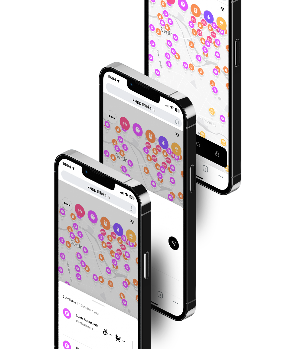
 Real-Time Mobility 360° – Berlin
Simplifying Urban Transport for Berlin and Its Surrounding Areas Through Mobility 360°
Insights:
Berlin, a bustling city with a diverse range of mobility solutions, faces a similar challenge to Barcelona. The myriad of car rental options available to residents and visitors alike are spread across various platforms, making it hard to get a holistic, real-time view of mobility choices.
Problem:
How to Develop a unified platform to provide real-time, comprehensive information on all available real-time transportation options and car rental options in the city.
Solutions:
Thinkz has stepped in to resolve this issue by offering a centralized, real-time view of car rental options available across Berlin. Our interactive, real-time map is accessible through both mobile and desktop interfaces and provides a multi-layered view of real-time mobility solutions including available rental cars, parking spaces, and EV charging stations.
Our solution adheres to GDPR guidelines, offering critical details such as the availability of rental cars, the number of return spots, and the number of available parking spaces.
With Thinkz’s patent-pending LDV technology, we ensure the accuracy of the data by connecting and verifying multiple IoT data sources in real time.
At Thinkz, data security is paramount. We are not data aggregators, all your data stays within your system. Plus, we don’t collect or store data from end users and IoT devices.
Advantages:
Since September 2022, residents and visitors of Berlin and its surrounding areas have enjoyed the benefits of the Mobility 360° platform:
Enhanced Convenience
Provides real-time information on the availability and location of e-scooters, e-bikes, and public transportation, simplifying planning and reducing search times.
Improved Mobility
With real-time updates on diverse transport modes, residents can make informed decisions to efficiently reach their destinations.
Sustainability Promotion
By providing real-time data on e-scooters and e-bikes, Thinkz’s platform promotes eco-friendly transportation.
Time Efficiency
Instant visibility of available transport modes reduces travel and waiting times.
Boosts Public Transport Usage
Real-time updates on public transportation schedules can motivate more residents to use these services, reducing congestion and carbon emissions.
