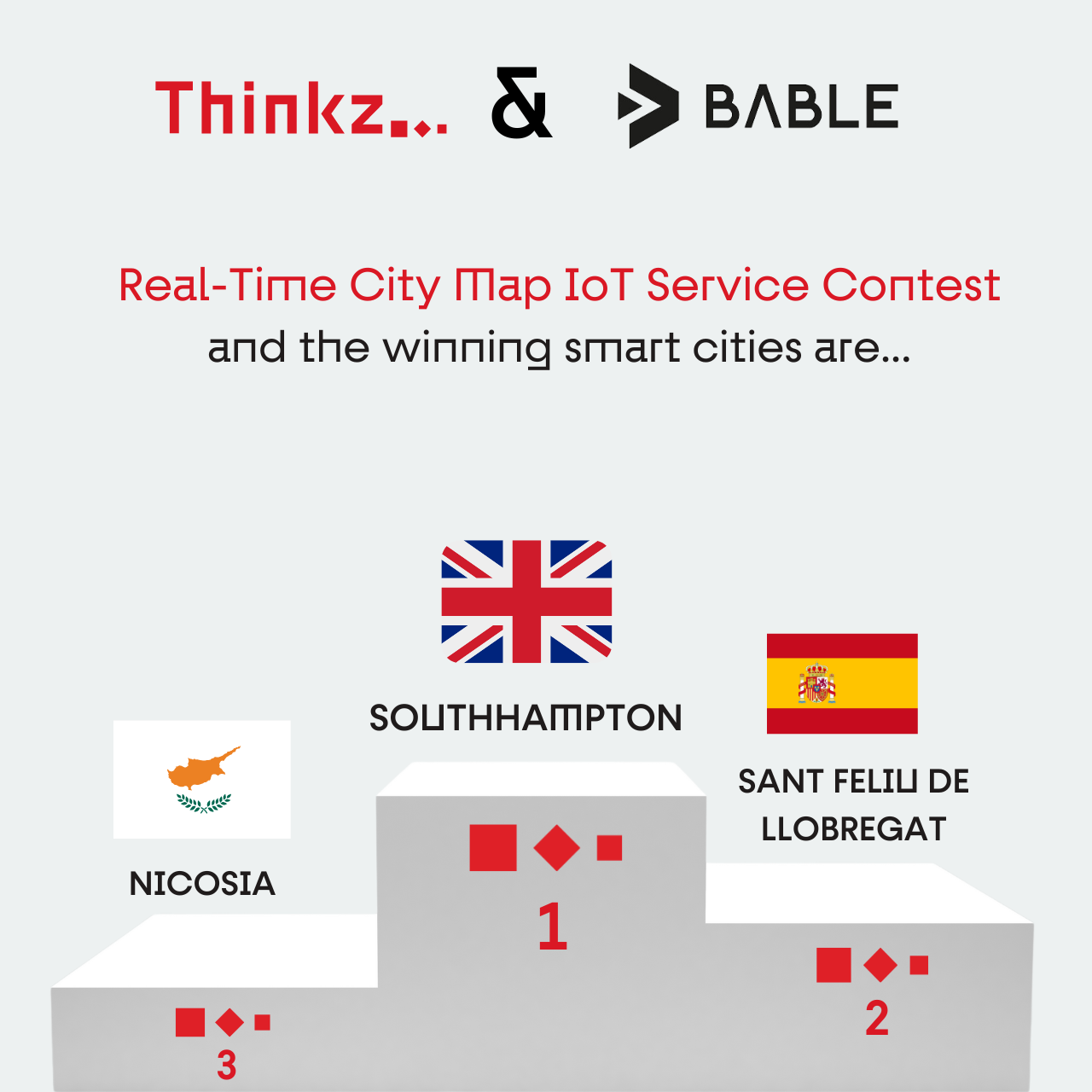
Join Thinkz & Bable Real-Time City Map IoT service Contest!
An Opportunity to Transform Your City with Real-Time IoT Data
Experience the Power of Real-Time presence: Get your city’s map animated in real time.
Choose Thinkz Real-Time services: The winner will have the opportunity to select one real-time service from our extensive list of available offerings.
IoT Integration on Thinkz Real-Time Map: We will integrate the city’s IoT data into our real-time map, bringing the chosen service to life.
Free Access for Citizens: The city’s inhabitants will enjoy free access to a dynamic, real-time map of the chosen service, fostering a smarter and more connected community.

Thinkz & Bable Contest – Smart City Real Time Map
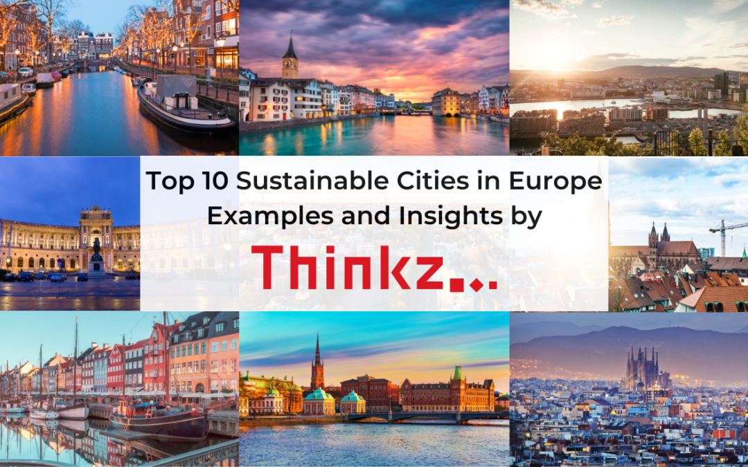
Top 10 Sustainable Cities in Europe: Examples and Insights
Europe is at the forefront of sustainable urban development, with many cities adopting innovative practices and advanced technologies to enhance urban living while minimizing their environmental impact. In this article, we will explore ten leading sustainable cities in Europe, showcasing their efforts and the benefits they bring to residents and visitors alike. We’ll also highlight how Thinkz’s real-time IoT solutions can support these cities in their sustainability goals.
10. Nicosia, Cyprus
Smart City Nicosia: Pioneering Sustainability with IoT Solutions
Nicosia’s Commitment to Smart Sustainability:
Nicosia is making significant strides in becoming Cyprus’s first integrated smart city. With Thinkz’s real-time IoT solutions, the city aims to enhance urban living and environmental sustainability.
Motivation and Challenges:
Nicosia addresses urban challenges like traffic congestion, waste management, and air quality by employing smart city solutions that promote eco-friendly behavior and efficient resource use.

Key Projects:
- Smart Infrastructure Development:
In partnership with Logicom Solutions and Cisco, Nicosia is developing next-generation data networks, intelligent street lighting, and smart mobility systems. The project, co-funded by European Structural and Investment Funds, aims to transform Nicosia into a smart city by 2022. - iNicosia Digital Twin:
CYENS Centre of Excellence is building a digital twin of Nicosia using CesiumJS. This 3D model integrates IoT data, visualizing city landmarks, road networks, environmental data, and more, facilitating better urban planning and public engagement. - Smart Waste Management:
Thinkz is collaborating with Smart Nicosia to implement IoT sensors that monitor the status of recycling bins, optimizing waste collection and improving recycling targets. For more details on how Thinkz is transforming urban living in Nicosia, visit our use cases. - Air Quality Monitoring and Routing:
Advanced sensors, installed by Thinkz, monitor air quality, and the air quality routing feature guides citizens through paths with the best air quality, enhancing public health and urban living.
Technologies Used:
- IoT sensors for air quality monitoring
- Real-time recycling bin status
- Air quality routing
- Smart lighting and traffic management systems
- Digital twin and 3D modeling
Benefits:
- Improved Air Quality: Real-time monitoring and air quality routing help reduce pollution exposure for residents.
- Efficient Waste Management: Smart waste systems optimize collection schedules, saving resources and boosting recycling rates.
- Enhanced Public Health: Monitoring air quality reducing traffic congestion and improving overall health and safety.
- Sustainability: Smart systems reduce the city’s environmental footprint, promoting sustainable urban development.
Global Leadership:
Nicosia’s comprehensive approach to smart city development, focusing on sustainability and quality of life, positions it as a leader in the Eastern Mediterranean. The city’s innovative use of IoT solutions sets a benchmark for other cities aiming to enhance urban living through technology and sustainability.
Sources
https://cesium.com/blog/2023/03/30/smart-city-infrastructure-in-cesiumjs-connecting-nicosia
https://knews.kathimerini.com.cy/en/news/inside-the-grand-unveiling-of-smart-nicosia-dreams
https://smartnicosia.eu/en/home#toolsforcitizens
9. Oslo, Norway
Smart City Oslo: Leading in Sustainability and Innovation
Oslo’s Commitment to Smart Sustainability:
Oslo is the capital of Norway, with a population of approximately 670,000 citizens. The Smart City initiative aims to improve the lives of citizens by being open, connected, sustainable, and innovative. The focus is on integrating new technology across various sectors to benefit the citizens.
Motivation and Challenges:
Oslo aims to reduce carbon emissions by 95% by 2030. The city focuses on electrifying public transport, promoting cycling, and using renewable energy. Smart city solutions address urban challenges such as traffic congestion and environmental impact.

Key Projects:
- FutureBuilt: Develops climate-neutral urban areas with high-quality architecture, aiming for a 50% reduction in emissions from transport, energy, and materials.
- Smart Public Transport: Oslo’s public transport is set to become emission-free by 2028. The city also has extensive cycling infrastructure.
- Green Buildings: The Powerhouse alliance is developing energy-positive buildings that generate more energy than they consume.
- Climate Dashboard: Visualizes real-time climate and environmental data to aid urban development and promote climate-friendly behavior.
Technologies Used:
- IoT sensors for air quality monitoring and smart waste management
- Electrified public transport systems
- Renewable energy systems and green roofs
- Open data platforms for real-time data sharing
- AI and machine learning for climate predictions
Benefits:
- Significant Emission Reductions: Through renewable energy systems and electrified transport.
- Enhanced Urban Biodiversity: Green roofs and walls contribute to sustainability.
- Improved Public Health: Better air quality and efficient waste management.
- Citizen Engagement: Open data platforms encourage participation in urban development.
Global Leadership:
Oslo is setting a benchmark for other cities in smart urban planning and sustainability. The city’s comprehensive approach to smart city development, with an emphasis on citizen well-being and environmental responsibility, positions it as a leader in urban innovation.
Sources:
https://doga.no/globalassets/pdf/smartby-veikart-19x23cm-eng-v1_delt.pdf
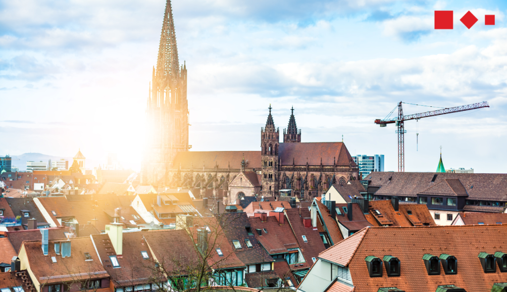
8. Freiburg, Germany
Smart City Freiburg: Championing Green Innovation and Sustainability
Freiburg’s Commitment to Sustainability: Freiburg, known as the “Green City,” is a leader in sustainability and renewable energy. Located near the Black Forest, the city aims for 100% renewable energy by 2035 and carbon neutrality by 2050. Freiburg’s strategies integrate renewable energy, eco-friendly transportation, and sustainable urban planning.
Motivation and Challenges: Freiburg tackles challenges like climate change, resource management, and sustainable growth through innovative smart city solutions and a focus on renewable energy.
Key Projects:
- Vauban District: A sustainable urban development featuring energy-efficient buildings, solar power, and car-free zones.
- Public Transport and Cycling Infrastructure: Extensive tram and bus networks, and dedicated cycling lanes promoting sustainable mobility.
- Renewable Energy Initiatives: Investments in solar energy, wind power, and biomass to reduce carbon emissions.
- Smart Climate City Strategy: Integrating urban and transport planning with digitalization and IoT for better environmental management.
Technologies Used:
- Solar panels and wind turbines
- Energy-efficient building materials and designs
- Smart grid technology
- IoT sensors for energy, water, and waste management
- Public transport and cycling infrastructure
Benefits:
- Reduced Carbon Emissions: Renewable energy initiatives significantly lower the city’s carbon footprint.
- Enhanced Quality of Life: Green spaces, efficient public transport, and sustainable urban planning improve residents’ living conditions.
- Economic Growth and Innovation: Freiburg’s focus on green technology fosters economic development and attracts environmental research and businesses.
- Public Engagement: Community involvement in sustainability projects encourages a culture of eco-conscious living.
Global Leadership: Freiburg’s holistic approach to sustainability and smart city initiatives positions it as a leader in green urban development. The city serves as an example of how integrating renewable energy, sustainable transport, and community engagement can create a livable and environmentally responsible urban environment.
Sources:
7. Barcelona, Spain
Smart City Barcelona: Integrating IoT for Urban Innovation and Sustainability
Smart City Barcelona: Barcelona integrates smart technology with sustainability initiatives, including smart lighting, waste management, and energy-efficient buildings. The city’s focus on digital innovation supports its sustainability goals and enhances the quality of urban life.
Motivation and Challenges:
Barcelona faced economic challenges after the 2008 recession and turned to technology to reinvent itself. The city identified key areas for intervention, such as transportation, water, energy, waste, and open government, and initiated multiple programs to enhance urban systems.

Key Projects:
- Smart City Barcelona Program: Initiated in 2012 to deploy responsive technologies across various urban systems, leveraging IoT.
- Sentilo Platform: Manages and shares data collected from 18,000 active sensors monitoring weather, electricity usage, water supply, air quality, and noise levels.
- Barcelona Lighting Masterplan: Transitioned over 1,100 lampposts to LED, reducing energy consumption and integrating air quality sensors.
- Smart Water Management: Implemented 20,000 smart meters to monitor and optimize irrigation, achieving a 25% increase in water conservation.
Technologies Used:
- IoT sensors for air quality, waste levels, and water usage
- Smart lighting systems with motion detection and air quality sensors
- Energy-efficient buildings with smart meters
- Open data platforms like Sentilo for real-time data sharing
- Fiber optic network supporting citywide WiFi and IoT systems
Benefits:
- Reduced Energy Consumption: Smart lighting and energy-efficient buildings lower the city’s energy usage.
- Lower Waste Levels: Optimized waste collection routes and monitored waste levels enhance efficiency.
- Improved Urban Living Conditions: Enhanced public transport, reduced congestion, and better air quality improve quality of life.
- Economic Growth and Job Creation: IoT initiatives generated significant cost savings and created thousands of new jobs.
Global Leadership:
Barcelona’s integration of IoT and smart city technologies positions it as a global leader in urban innovation. The city’s comprehensive approach to sustainability and digital innovation serves as a model for other cities worldwide, demonstrating how smart solutions can create a more sustainable and livable urban environment.
Sources:
https://www.iotnewsportal.com/cities/how-the-smart-city-barcelona-brought-iot-to-life
https://ajuntament.barcelona.cat/digital/ca
6. Zurich, Switzerland
Zurich Smart City: Integrating Sustainability and Innovation for a Better Urban Future
Zurich’s Commitment to Sustainability: Zurich focuses on sustainable mobility, green buildings, and efficient waste management. The city promotes the use of public transport and electric vehicles, supported by a comprehensive smart city strategy.
Motivation and Challenges: Zurich aims to address urban challenges such as waste management, emissions, and public health by leveraging technology and innovative solutions.

Key Projects:
- Smart Waste Management: IoT sensors monitor waste levels in bins, optimizing collection routes and reducing costs.
- Smart Lighting: Adaptive streetlights with IoT sensors adjust to traffic and environmental conditions, conserving energy.
- Smart Public Transport: Real-time data from IoT devices enhances the efficiency and reliability of Zurich’s extensive public transport network.
- Environmental Monitoring: IoT sensors track air quality and weather conditions for better urban management.
- Power-to-Heat (P2H) System: Uses excess renewable energy to produce heat for buildings in the city’s district heating network.
- eZürich: Promotes digital technologies to improve public services and citizen participation.
- Smart Parking: Guides drivers to available parking spaces in real-time, reducing traffic congestion.
- Climate-friendly Construction: Initiatives promote sustainable building practices.
Technologies Used:
- Waste-to-energy plants
- Electric vehicle infrastructure
- IoT sensors and real-time data analytics
- Renewable energy systems (geothermal and solar power)
Benefits:
- Reduced Waste: Efficient waste management and recycling.
- Lower Emissions: Sustainable public transport and electric vehicle infrastructure.
- Improved Public Health: Better air quality and reduced pollution.
- Enhanced Mobility: Smart traffic and transport solutions reduce congestion and improve efficiency.
- Economic Growth: Innovation and entrepreneurship in smart technologies.
- Citizen Engagement: Digital platforms for public participation and feedback.
Global Leadership:
Zurich’s smart city initiatives position it as a global leader in sustainability and urban innovation. The city’s comprehensive approach demonstrates how technology can create a more sustainable and livable urban environment.
https://www.greaterzuricharea.com/en/news/zurich-again-crowned-worlds-smartest-city
https://www.aboutsmartcities.com/smart-city-zurich/
5. Amsterdam, Netherlands
Amsterdam Smart City: Pioneering Urban Innovation and Sustainability
Amsterdam’s Commitment to Smart City Development: Amsterdam, the capital of the Netherlands, is recognized as one of the leading smart cities in Europe. The city’s smart city strategy, initiated in 2009, focuses on leveraging technology and data to enhance sustainability, improve quality of life, and foster innovation.
Motivation and Challenges: Amsterdam aims to address urban challenges such as traffic congestion, energy consumption, and environmental impact. By implementing smart city solutions, the city seeks to create a more livable, sustainable, and economically vibrant urban environment.

Key Projects:
- Amsterdam Smart City Platform: A collaborative online platform that connects over 4000 members and facilitates the development of smart city projects across six main areas: Infrastructure & Technology, Energy, Water & Waste, Mobility, Circular City, Governance & Education, and Citizens & Living.
- Smart Traffic Management: Utilizes IoT sensors and real-time data to optimize traffic flow, reduce congestion, and lower emissions, resulting in a 43% reduction in the time required to find parking.
- Circular Economy Initiatives: Projects like the Circular City Scan and Power to Protein aim to reduce waste and promote resource regeneration, contributing to sustainable urban living.
- Digital Demo Amsterdam: A partnership with major companies to test and develop sustainable, innovative, and digital solutions for the city’s future.
- Smart Lighting Solutions: Implementation of LED lighting and smart lampposts with environmental sensors to reduce energy consumption and enhance public safety.
Technologies Used:
- IoT sensors and real-time data analytics
- Renewable energy and smart grid systems
- Open data platforms and APIs
- Machine learning and AI-driven solutions
- Advanced fiber optic networks
Benefits:
- Enhanced Quality of Life: Smart services improve urban living through efficient public services, reduced traffic congestion, and better resource management.
- Sustainability: Initiatives like smart traffic management and circular economy projects reduce carbon emissions and promote eco-friendly practices.
- Economic Growth: Amsterdam’s smart city strategy fosters innovation, attracts international talent, and boosts the local economy.
- Citizen Engagement: Open data platforms and community-driven projects encourage active citizen participation and co-creation of smart city solutions.
Global Leadership: Amsterdam’s comprehensive approach to smart city development positions it as a global leader in urban innovation. By integrating technology, sustainability, and citizen engagement, Amsterdam sets a benchmark for other cities worldwide, demonstrating how smart solutions can create a more sustainable and resilient urban future.
Sources:
https://www.beesmart.city/en/smart-city-blog/smart-city-stockholm
https://www.aboutsmartcities.com/amsterdam-smart-city/
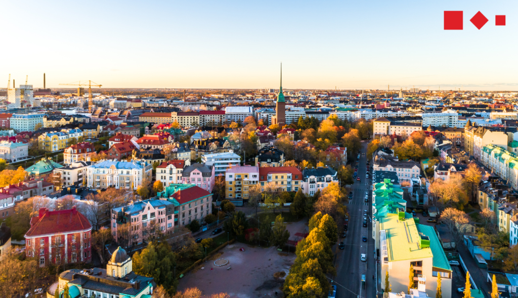
4. Helsinki, Finland
Smart City Helsinki: A Leader in Innovation and Sustainability
Helsinki’s Vision:
Helsinki aims to be the world’s most functional city by 2025, driven by Smart City initiatives that enhance urban living, sustainability, and economic growth.
Motivation and Challenges:
Facing challenges like urban growth, traffic congestion, and climate change, Helsinki employs smart city solutions to improve quality of life and sustainability.
Key Projects:
- Digital Twin:
A virtual twin of Helsinki simulates city conditions, aiding in urban planning and traffic management. - Smart Mobility:
The Mobility Lab Helsinki uses real-time traffic data and AI to optimize traffic flow and reduce emissions. Projects like the Trombia Free automated street sweeper exemplify these efforts. - Climate-Neutrality:
Helsinki targets carbon neutrality by 2035. Projects like Kalasatama focus on integrating renewable energy and smart home solutions in residential areas. - AI Innovations:
AI is used extensively, from detecting brain disorders at Helsinki University Hospital to monitoring indoor air quality through the Quasimodo project. - Smart Buildings:
Retrofitting projects like Merihaka and Vilhonvuori equip buildings with smart thermostats and integrate renewable energy systems. - Data-Driven Tourism:
DataLokki platform provides real-time tourism data, supporting decision-making in the tourism industry.
Technologies Used:
- IoT sensors and real-time data analytics
- AI and machine learning for health and environmental monitoring
- Smart grids and renewable energy sources
- Open data platforms
Benefits:
- Reduced Carbon Emissions:
Renewable energy projects and smart building technologies significantly lower carbon footprints. - Improved Air Quality:
AI and IoT solutions monitor and improve both outdoor and indoor air quality. - Efficient Resource Use:
Smart systems optimize energy and resource consumption, lowering operational costs. - Sustainable Mobility:
Smart traffic and mobility solutions reduce congestion and emissions. - Economic Growth:
Smart city initiatives attract international talent, foster innovation, and boost the local economy. - Enhanced Quality of Life:
Projects focused on green spaces, smart homes, and efficient public transport improve urban living. - Citizen Engagement:
Open data platforms enable residents to actively participate in and benefit from smart city projects.
Global Leadership:
Helsinki’s comprehensive approach to integrating technology, sustainability, and citizen-centric solutions makes it a model for smart city development worldwide. The city’s commitment to innovation and environmental stewardship demonstrates how technology can create a more sustainable and livable urban environment.
Source
https://www.mysmartlife.eu/cities/helsinki/
3. Vienna, Austria
Smart City Vienna: Leading with Sustainability and Quality of Life
Vienna’s Commitment to Sustainability: Vienna, Austria’s largest city, aims to become climate-neutral by 2040. The city is celebrated for its outstanding public transport system, expansive green spaces, and quality of life. Vienna’s Smart Climate City Strategy focuses on integrating urban and transport planning to create a sustainable, liveable environment.
Motivation and Challenges: Vienna addresses challenges such as urban growth, traffic congestion, and environmental impact by promoting smart city solutions that enhance sustainability and improve residents’ quality of life.

Key Projects:
- Smart Traffic Management: Uses real-time data to optimize traffic flow and reduce congestion through smart traffic lights and sensors.
- E-Mobility Investments: Federal investments in e-mobility promote the intersection of environmental protection and individual mobility.
- Green Spaces and Public Transport: Nearly half of Vienna is green, and the city boasts an affordable, efficient public transport network with ongoing improvements.
- Smart Water Management: Utilizes IoT sensors for efficient water usage and to reduce waste.
- Smart Waste Management: Implements IoT-enabled systems to optimize waste collection and recycling.
Technologies Used:
- Smart traffic lights
- E-mobility infrastructure
- Real-time traffic management systems
- Renewable energy sources
- Open data platforms
- IoT sensors for water and waste management
Benefits:
- Reduced Carbon Emissions: Sustainable transport and energy-efficient buildings lower the city’s carbon footprint.
- Enhanced Quality of Life: Extensive green spaces, clean public transport, and excellent public services contribute to Vienna’s high livability.
- Economic Growth and Innovation: Investments in smart technologies foster economic development and attract international talent.
- Public Engagement: Open data initiatives encourage citizen participation in sustainability efforts and urban management.
Global Leadership: Vienna’s comprehensive approach to smart city development and commitment to sustainability position it as a global leader. The city serves as a model for others aiming to enhance urban living through innovative, sustainable solutions.
Sources:
https://smartcity.wien.gv.at/wp-content/uploads/sites/3/2022/05/scwr_klima_2022_web-EN.pdf
2. Stockholm, Sweden
Smart City Stockholm: Pioneering Sustainability and Innovation
Stockholm’s Commitment to Sustainability: Stockholm, the capital of Sweden, is on a mission to become the world’s smartest city by 2040, aligning this goal with becoming carbon-neutral. The city is renowned for its ambitious sustainability efforts, smart city initiatives, and a blend of historical charm with modern infrastructure.
Motivation and Challenges: Stockholm faces urban challenges such as population growth, traffic congestion, and environmental impact. To address these, the city emphasizes smart city solutions that enhance sustainability, improve quality of life, and foster economic growth.

Key Projects:
- Stockholm Royal Seaport: A sustainable urban development project that integrates energy-efficient buildings, smart grids, and renewable energy sources.
- Smart Traffic Management: Utilizes real-time data and IoT sensors to optimize traffic flow, reduce congestion, and lower emissions through induction loops and sensors.
- Climate-Smart Mobility: Promotes electric vehicles, shared mobility services, and extensive cycling infrastructure to reduce carbon footprint.
- Hammarby Sjöstad: An eco-friendly district with integrated waste, energy, and water management systems, exemplifying sustainable urban living.
- Digital Demo Stockholm: A collaborative initiative with the Royal Institute of Technology and leading companies to run projects with sustainable, innovative, and digital solutions.
- DOLL Living Lab: An outdoor “Street Lab” that tests smart lighting, parking, waste, and environmental sensor solutions.
Technologies Used:
- Smart grids and renewable energy sources
- Real-time traffic management systems
- Electric vehicle charging infrastructure
- Integrated waste, energy, and water management systems
- IoT sensors for environmental monitoring and resource management
- Open data platforms
Benefits:
- Reduced Carbon Emissions: Optimization of energy consumption and promotion of renewable energy reduce the city’s carbon footprint.
- Improved Air Quality: Initiatives like Project Air View, in collaboration with Google, measure and help combat air pollution.
- Efficient Resource Use: AI and machine learning optimize energy consumption and resource management, lowering costs and ecological impact.
- Sustainable Mobility: Smart traffic and mobility solutions reduce congestion, emissions, and energy consumption.
- Economic Growth and Innovation: Partnerships with tech companies foster innovation, create job opportunities, and attract international talent.
- Enhanced Quality of Life: Smart services, including e-services and smart lighting, improve public safety, health, and overall urban living experience.
- Citizen Engagement: Open data initiatives encourage residents to actively participate in sustainability efforts and smart city solutions.
Global Leadership: Stockholm’s holistic approach to sustainability and smart city initiatives positions it as a global leader in urban innovation. The city’s commitment to environmental protection, technological advancement, and citizen engagement serves as a model for other cities worldwide, demonstrating how smart solutions can create a more sustainable and livable urban environment.
Sources:
https://www.beesmart.city/en/smart-city-blog/smart-city-stockholm
1. Copenhagen, Denmark
Smart City Copenhagen: World’s First Climate-Neutral Capital
Copenhagen’s Ambitious Goals: Copenhagen aims to become the world’s first climate-neutral capital by 2025, driven by Smart City initiatives to enhance urban living and environmental sustainability.
Motivation and Challenges: The city focuses on reducing CO2 emissions, addressing urban challenges like population growth and traffic, and fostering economic and technological advancements through external partnerships and innovation.

Key Projects:
- Project Air View: Measures street-level air pollution with Google, informing policy to combat air pollution.
- Signature AI Project: Uses AI to optimize energy consumption in municipal buildings, saving energy and reducing CO2 emissions.
- RAPID: Develops digital tools for pandemic-related public space management, including a 3D model of Copenhagen Central Station.
- Street Lab: Tests solutions to reduce CO2 emissions, operational costs, and enhance public services with partners like Cisco.
- DOLL (Danish Outdoor Lighting Lab): Features outdoor lighting and sensor solutions to reduce electricity consumption and improve citizen safety.
Technologies Used:
- Smart traffic lights and intelligent traffic systems
- District heating networks powered by renewable energy
- Smart streetlights
- Open-data platform for real-time data sharing
- IoT sensors for environmental monitoring and resource management
Benefits:
- Reduced carbon emissions and improved air quality
- More efficient use of resources
- Enhanced quality of life through smarter urban planning and citizen engagement
- Economic growth and job creation through innovation and partnerships
Global Leadership: Copenhagen’s commitment to sustainability and smart city initiatives positions it as a global leader, setting a benchmark for other cities pursuing similar goals. The city’s innovative approaches, including collaborations with technology giants like Cisco, demonstrate how technological advancements and environmental protection can work hand in hand to create a more sustainable and livable urban environment.
Sources:
https://www.beesmart.city/en/smart-city-blog/copenhagen
Conclusion
Europe’s leading sustainable cities, including Copenhagen, Stockholm, Amsterdam, Vienna, Freiburg, Zurich, Helsinki, Nicosia, Oslo, and Barcelona, demonstrate the potential of integrating smart city technologies to enhance urban living and promote sustainability. Through innovative projects focusing on energy efficiency, waste management, and IoT solutions, these cities address urban challenges, reduce their environmental footprint, and improve the quality of life for residents. Their comprehensive approaches and commitment to sustainability serve as models for cities worldwide, showcasing the transformative power of technology in creating a more sustainable future.
Thinkz we did
Use cases that are already leveraging
the Power of Real-Time Data


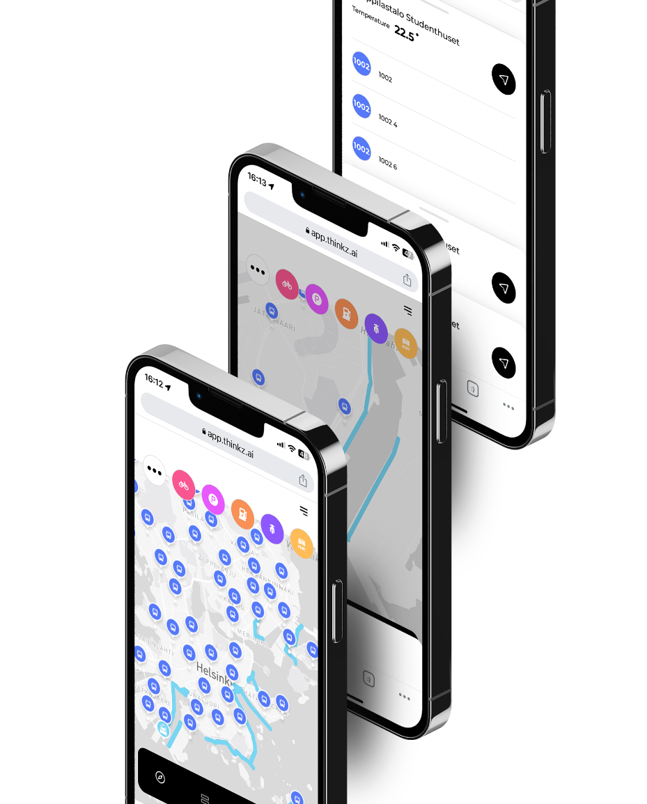
 REAL-TIME Digital Twin Mobility – Helsinki city
Revolutionizing Helsinki’s Snow Plow System with Digital Twin Technology
Insights:
The residents and transportation services in the snowy city of Helsinki require up-to-date information on which roads have been cleared of snow in real-time. This information is crucial in helping them plan their journeys more safely and efficiently, whether it be choosing their route or determining if public transportation is an option.
Problem:
Residents of snowy cities require real-time updates on which roads have been cleared of snow to plan their journeys more safely and efficiently.
Solutions:
Real-time snowplow mapping uses intelligent technologies and mapping software to track and display snowplow locations and progress. By harnessing the power of IoTs on the city’s snow plows and other connected devices, the collected data can be transformed into real-time information and displayed on a live map.
The solution also includes multiple layers of information, connecting the snow-cleared route map to the city’s public and private transportation systems. The revolutionary pattern pending LDV technology by Thinkz ensures the accuracy of the data by connecting and verifying multiple sources of IoT data in real-time.
Digital Twins technology allows the solution to connect other IoT devices in the city, providing data from multiple sources in real-time. This data is transformed into a single, verified information source through the revolutionary pattern pending LDV technology by Thinkz.
Advantages:
Real-time snowplow mapping offers many benefits for the citizens :
Real-time road condition updates:
Enhances driver safety and informs route decisions.
Travel planning made easy:
Residents can plan trips and errands based on cleared roads.
Avoid uncleared roads:
Real-time mapping helps minimize travel time and reach destinations faster.
Informed route choices:
Reduces accident risk and improves overall road safety.
Current road status information:
Alleviates concerns and promotes peace of mind for residents.
 Real-Time Air quality & Mobility – Westminster London City Hall
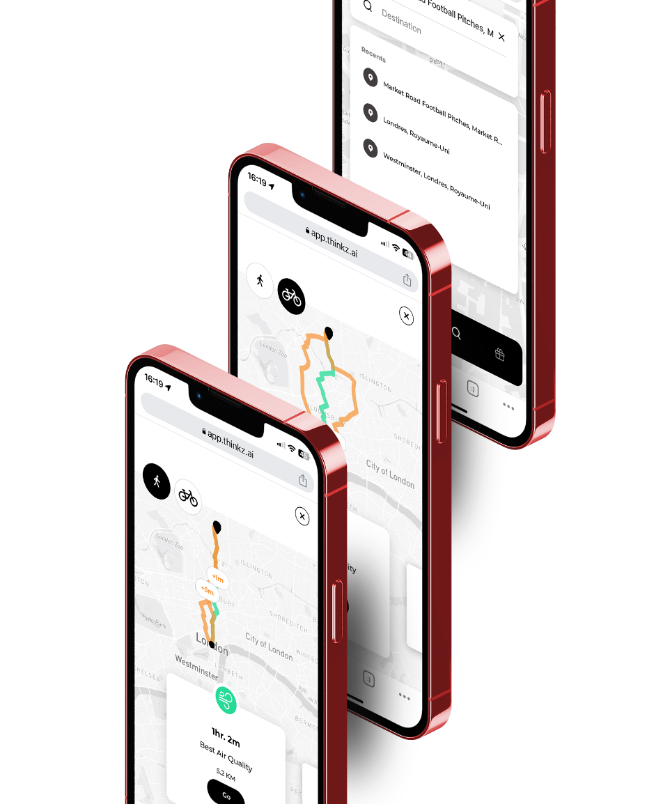
Dynamic Clean-Air Routing: Utilizing IoT for Sustainable Living & Urban Mobility
Insights:
Access to real-time air quality data is essential for citizens to make informed decisions about their daily activities, leading to a healthier and more sustainable environment for all.
Problem:
Isolation of IoT devices due to cyber protection and privacy concerns prevents citizens from accessing air quality information. The challenge is to create a global network of IoT devices to provide free access to real-time air quality data in urban areas.
Solutions:
Collaboration between IoT devices provides boundless possibilities for enhancing urban living. Our innovative technology assimilates data from a variety of IoT devices, including CO2 sensors, to offer citizens real-time maps detailing the quickest and cleanest walking or cycling routes to their destinations.
This GDPR-compliant solution also delivers crucial information such as travel duration, air pollution levels, and street capacity.
The revolutionary pattern pending LDV technology by Thinkz ensures the accuracy of the data by connecting and verifying multiple sources of IoT data in real-time.
We are not data aggregators: All your data stays within your system. Further, we don’t collect or store data from end users and IOT devices.
Advantages:
Since DECEMBER 2022- Westminister’s citizens get access to cleaner air routes
Real-time air quality insights
enable informed decision-making for citizens’ daily activities, promoting healthier and more sustainable lifestyles.
Breaks the barriers of IoT device isolation
by harmonizing data from diverse IoT devices, including CO2 sensors and pedestal route.
Providing real-time maps
presenting the fastest and cleanest routes to citizens’ destinations.
Enhancing daily commuting experiences,
fostering more efficient and sustainable urban living.
Citizens can use Thinkz’s user-friendly real-time map to view all relevant air quality data on their route, empowering them to make informed decisions about their daily activities.
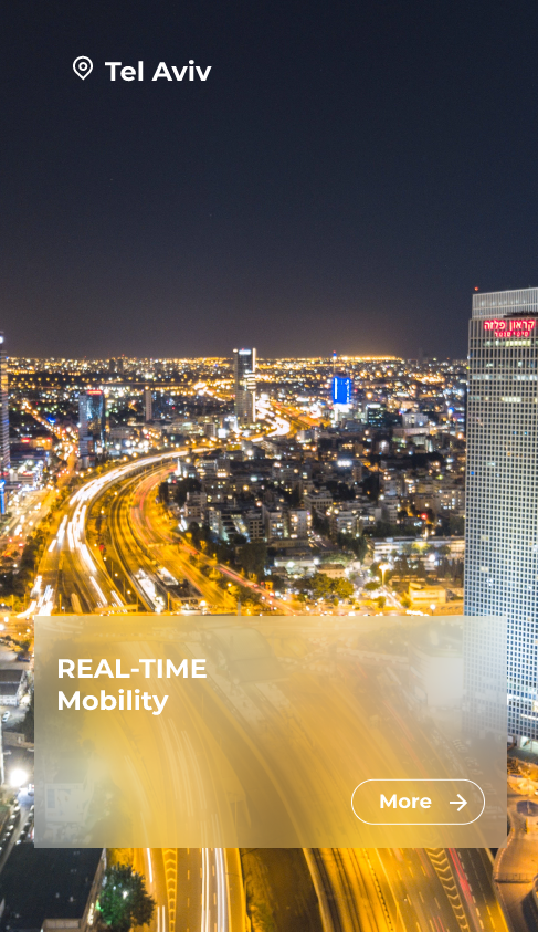
 Real-Time Mobility – Tel Aviv
Dynamic Clean-Air Routing: Utilizing IoT for Sustainable Living & Urban Mobility
Insights:
Tel Aviv, known for its vibrant life and bustling streets, offers an extensive range of micromobility options. Despite this, these options are spread across numerous apps, creating a disjointed experience for residents who cannot access real-time, consolidated information
Problem:
How to provide city residents with comprehensive, real-time information on all available public transportation options?
This requires the integration of unused data from multiple IoT devices, each with different owners and protocols, and the establishment of a machine-learning Live data verification to ensure data accuracy.
Solutions:
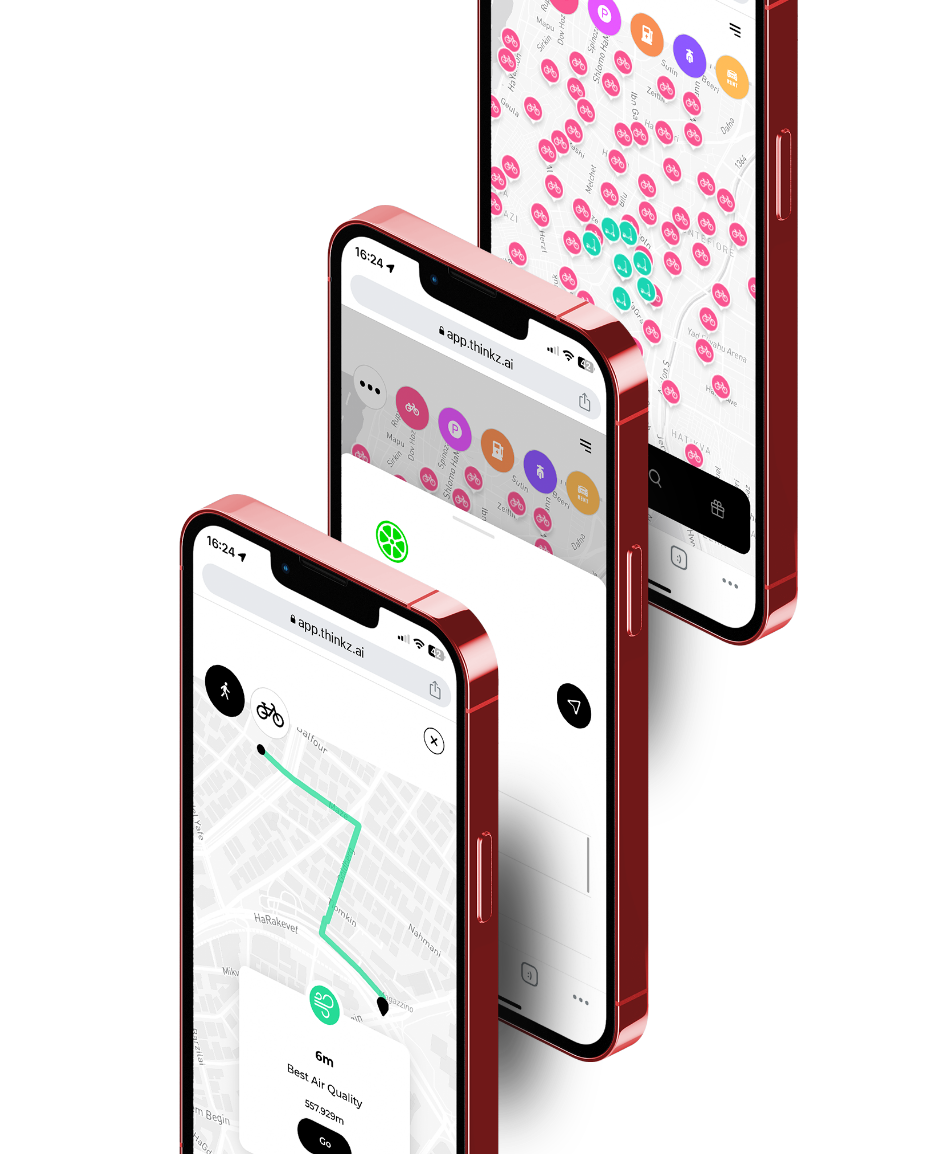
Thinkz addresses this issue with a unified platform providing real-time insights into all available micromobility options, including scooters and electronic rentals. This easily navigable, interactive real-time map is accessible on both mobile and desktop interfaces. It includes real-time information on available e-scooters, e-bikes, and other relevant public transportation options.
Our GDPR-compliant solution delivers vital information such as the availability and battery level of e-scooters and e-bikes, helping users make informed choices.
With Thinkz’s groundbreaking LDV technology, we ensure data accuracy by connecting and verifying multiple real-time IoT data sources.
Your data security is our priority. We don’t aggregate data; all your data stays within your system. Additionally, we don’t collect or store data from end users and IoT devices.
Advantages:
Since September 2022, Tel Aviv residents have been reaping the benefits of the Mobility 360° platform
Enhanced Convenience
Provides real-time information on the availability and location of e-scooters, e-bikes, and public transportation, simplifying planning and reducing search times.
Improved Mobility
With real-time updates on diverse transport modes, residents can make informed decisions to efficiently reach their destinations.
Sustainability Promotion
By providing real-time data on e-scooters and e-bikes, Thinkz’s platform promotes eco-friendly transportation.
Time Efficiency
Instant visibility of available transport modes reduces travel and waiting times.
Boosts Public Transport Usage
Real-time updates on public transportation schedules can motivate more residents to use these services, reducing congestion and carbon emissions.
 Real-Time Mobility 360° – Barcelona
Streamlining Urban Transport for Barcelona’s Residents through Mobility 360°
Insights:
While the city of Barcelona offers an array of options for optimizing urban mobility, these solutions are scattered across multiple applications. This fragmentation prevents residents from having a centralized and comprehensive overview of real-time mobility solutions.
Problem:
How to create a unified platform that provides city residents with comprehensive, real-time information on all available mobility options.
Solutions:
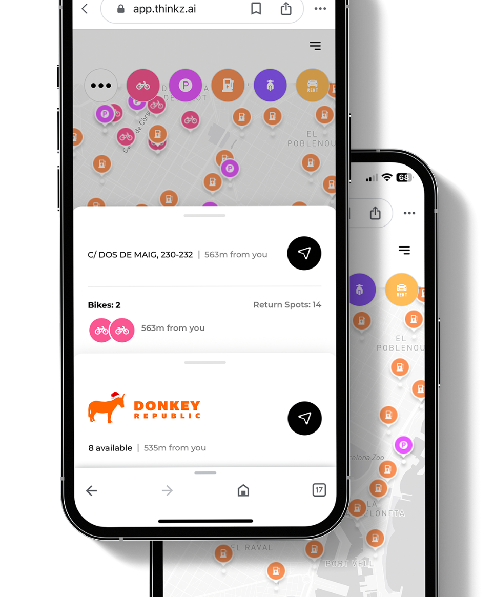
Thinkz addresses this challenge by presenting a centralized, real-time view of various mobility options, including micro-mobility devices such as scooters and bikes, along with real-time information for drivers such as available parking spots and EV charging stations. This solution manifests in a multi-layered, interactive, real-time map that’s intuitive to use on both mobile and desktop interfaces.
Our GDPR-compliant solution also provides vital details such as scooter and bike battery levels, the availability of return spots, and the number of available parking spaces.
Live Data Verification (LDV): Thinkz’s innovative and patent-pending LDV technology ensures data accuracy by verifying and connecting multiple sources of IoT data in real-time.
At Thinkz, we prioritize your data security: we do not aggregate data, and all your data remains within your system. Furthermore, we do not collect or store data from end users or IoT devices.
Advantages:
Since September 2022, Barcelona’s residents have benefitted from the Mobility 360° platform:
Enhanced Convenience
Provides real-time information on the availability and location of e-scooters, e-bikes, and public transportation, simplifying planning and reducing search times.
Improved Mobility
With real-time updates on diverse transport modes, residents can make informed decisions to efficiently reach their destinations.
Sustainability Promotion
By providing real-time data on e-scooters and e-bikes, Thinkz’s platform promotes eco-friendly transportation.
Time Efficiency
Instant visibility of available transport modes reduces travel and waiting times.
Boosts Public Transport Usage
Real-time updates on public transportation schedules can motivate more residents to use these services, reducing congestion and carbon emissions.
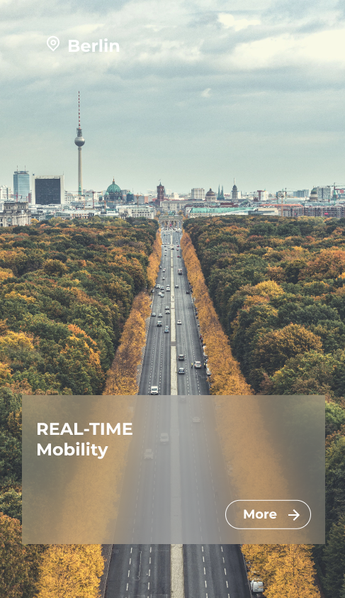
 Real-Time Mobility 360° – Berlin
Simplifying Urban Transport for Berlin and Its Surrounding Areas Through Mobility 360°
Insights:
Berlin, a bustling city with a diverse range of mobility solutions, faces a similar challenge to Barcelona. The myriad of car rental options available to residents and visitors alike are spread across various platforms, making it hard to get a holistic, real-time view of mobility choices.
Problem:
How to Develop a unified platform to provide real-time, comprehensive information on all available real-time transportation options and car rental options in the city.
Solutions:
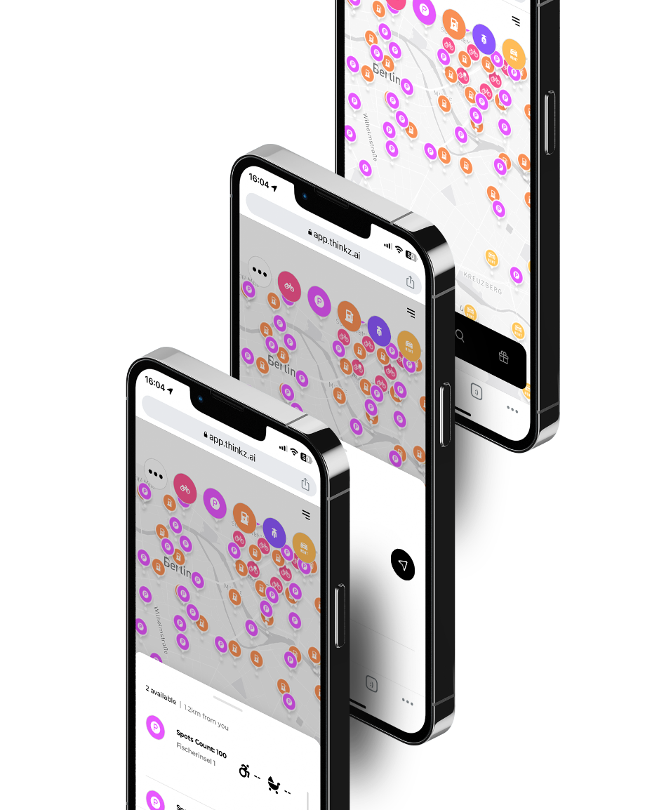
Thinkz has stepped in to resolve this issue by offering a centralized, real-time view of car rental options available across Berlin. Our interactive, real-time map is accessible through both mobile and desktop interfaces and provides a multi-layered view of real-time mobility solutions including available rental cars, parking spaces, and EV charging stations.
Our solution adheres to GDPR guidelines, offering critical details such as the availability of rental cars, the number of return spots, and the number of available parking spaces.
With Thinkz’s patent-pending LDV technology, we ensure the accuracy of the data by connecting and verifying multiple IoT data sources in real time.
At Thinkz, data security is paramount. We are not data aggregators, all your data stays within your system. Plus, we don’t collect or store data from end users and IoT devices.
Advantages:
Since September 2022, residents and visitors of Berlin and its surrounding areas have enjoyed the benefits of the Mobility 360° platform:
Enhanced Convenience
Provides real-time information on the availability and location of e-scooters, e-bikes, and public transportation, simplifying planning and reducing search times.
Improved Mobility
With real-time updates on diverse transport modes, residents can make informed decisions to efficiently reach their destinations.
Sustainability Promotion
By providing real-time data on e-scooters and e-bikes, Thinkz’s platform promotes eco-friendly transportation.
Time Efficiency
Instant visibility of available transport modes reduces travel and waiting times.
Boosts Public Transport Usage
Real-time updates on public transportation schedules can motivate more residents to use these services, reducing congestion and carbon emissions.
